


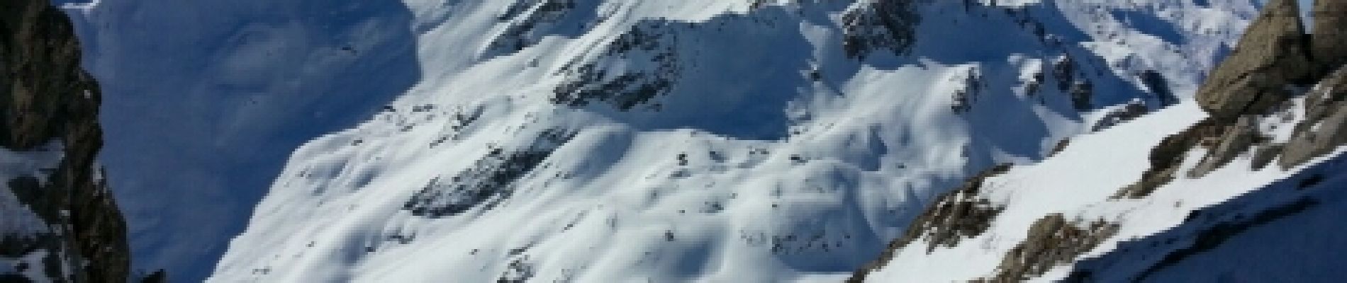
breche de gargan

melsacri
User
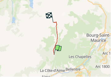

Length
9.2 km

Max alt
2672 m

Uphill gradient
1260 m
Km-Effort
22 km

Min alt
1402 m

Downhill gradient
6 m
Boucle
No
Creation date :
2014-12-10 00:00:00.0
Updated on :
2014-12-10 00:00:00.0
4h39
Difficulty : Very difficult

FREE GPS app for hiking
 SityTrail
IGN / Geographical institutes
SityTrail Plus
The world is yours!
About
Trail Other activity of 9.2 km to be discovered at Auvergne-Rhône-Alpes, Savoy, La Plagne-Tarentaise. This trail is proposed by melsacri.
Photos


Positioning
Country:
France
Region :
Auvergne-Rhône-Alpes
Department/Province :
Savoy
Municipality :
La Plagne-Tarentaise
Location:
La Côte-d'Aime
Start:(Dec)
Start:(UTM)
318327 ; 5051325 (32T) N.
Comments